

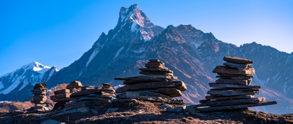


Overview
The Annapurna Circuit Trek is one of Nepal’s most iconic and rewarding trekking routes, renowned for its breathtaking landscapes, diverse cultural experiences, and ever-changing natural scenery. This incredible journey encircles the Annapurna Massif, home to Annapurna I (8,091 meters), the 10th highest peak in the world. Trekkers are treated to panoramic mountain views, deep gorges, picturesque villages, and a wide range of climatic zones, making it one of the most diverse treks globally.
One of the key attractions of this trek is its scenic diversity. The trail takes you through lush subtropical forests, cascading waterfalls, terraced farmlands, and alpine meadows before reaching the rugged, high-altitude desert landscapes of the Tibetan Plateau. Each section of the trek offers a new perspective of Nepal’s stunning geography, ensuring that no two days feel the same.
Beyond its natural beauty, the trek also offers rich cultural immersion. Along the route, you will pass through villages inhabited by different ethnic groups, such as the Gurung, Magar, Thakali, and Tibetan-influenced communities. These villages provide insight into local traditions, with opportunities to visit ancient monasteries, observe traditional farming practices, and interact with warm and welcoming locals. The unique blend of Hindu and Buddhist influences is evident throughout the trek, reflected in the temples, stupas, prayer flags, and Mani walls along the trail.
The Annapurna Circuit is accessible to trekkers with moderate to high fitness levels, and while it presents some challenges, it is suitable for both novice and experienced hikers with proper acclimatization. The trek is best undertaken during the spring (March-May) and autumn (September-November) seasons, when the skies are clear, temperatures are pleasant, and the mountain views are at their finest.
Trip highlights
- Scenic Diversity – Experience dramatic changes in landscapes, from lush subtropical forests and terraced fields to alpine meadows and arid, high-altitude deserts.
- Thorong La Pass (5,416m) – Conquer one of the highest trekking passes in the world, offering breathtaking views of the Himalayas.
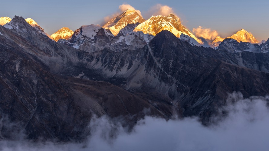
- Panoramic Mountain Views – Witness stunning sights of Annapurna I (8,091m), Dhaulagiri (8,167m), Machhapuchhre (6,993m), Manaslu (8,163m), and Tilicho Peak (7,134m).
- Cultural Immersion – Trek through traditional villages inhabited by Gurung, Magar, Thakali, and Tibetan-influenced communities, experiencing their unique customs, festivals, and warm hospitality.
- Ancient Monasteries & Temples – Visit sacred Buddhist monasteries, Mani walls, stupas, and Hindu pilgrimage sites like Muktinath Temple, revered by both Hindus and Buddhists.
- Tatopani Hot Springs – Relax in the natural hot springs of Tatopani, a perfect way to rejuvenate after long trekking days.
Itinerary
Arrive Kathmandu Tribhuvan International Airport, you will be met and welcomed by our representative. Please look for signage of your name once you come out of Arrival Terminal Hall after collecting your luggage. You will be escorted by our representative to the hotel
Welcome to Kathmandu, capital of the ancient Mountain Kingdom of Nepal, has the air of a medieval city with a maze of narrow streets, wooden temples and beautifully decorated palaces.
Upon arrival at the hotel, you will be provided welcome drinks along with the room key. Before you check in at your room, there will be a short trek briefing by our trek guide as you drive to Pokhara tomorrow in the morning so that our guide make sure that you will be well equipped for trekking ahead.
Overnight at the hotel
Meals Included: None
Accommodation: Standard Hotel
Altitude: 1336 Meter
Today you will be picked up from your hotel for the drive to Jagat. Your journey takes you through deep gorges as you trace the Trisuli River westwards. You will pass through the small town of Mugling where the Trisuli and Marshyangdi rivers meet. The town also serves as the crossroads between Kathmandu, Pokhara and Chitwan in the south. You pass over an impressive suspension bridge and begin to follow the Marshyangdi River, which will become a familiar sight, as it will be your companion all the way to Thorong Phedi. On this section of the road you will gain your first sight of the Annapurna and Manaslu ranges. After Mugling you turn north and the Annapurna Massif looms as you approach Besi Sahar. From here you will join a jeep track for a couple of hours passing through the villages of Syange and Jagat to reach the trek start point.
Jagat is a very old village. Its name means 'toll-station', as this was once a tax collecting point for the Tibetan salt trade. When Bill Tilman visited the area in 1950 this route did not exist. Instead he had to walk along a series of wooden galleries tied to the rock face!
Dinner and overnight at the local lodge (Teahouse)
Meals Included: B/L/D
Accommodation: Local Tea House
Altitude: 1300 Meter
The trail from Jagat descends until it reaches the river and then continues through a lush forest, before ascending to a sharp-edged cliff facing the riverbank. After crossing a suspension bridge, we climb steeply on the path to Sattale and then to Tal. As we walk away from Tal, the path becomes rugged and winding and we pass the forested village of Karte and Dharepani before we finally reach Bagarchap. Annapurna II becomes visible as we arrive at Bagarchap, a Bhotia village with colourful prayer flags.
Dinner and overnight at the local lodge (Teahouse)
Meals Included: B/L/D
Accommodation: Local Tea House
Altitude: 1700 Meter
As we continue ascending through forests of pine and oak, we pass through Dhanakyu before coming to a large waterfall. Further on, the Marshyangdi River enters a gorge and the trail follows a rock-strewn path. When the steep incline ends, we follow a path amid rhododendrons and continue on a gently rising path. We cross a stream before entering a pine forest. We then enter the hamlet of Kotho, from where we can get a good view of Annapurna II. The route reaches a large white gate with a corrugated iron roof, which is the entrance of Chame, the administrative headquarters of Manang district. There is electricity, shops, health post, post office and banks in Chame. The hot springs are a major attraction too.
Dinner and overnight at the local lodge (Teahouse)
Meals Included: B/L/D
Accommodation: Local Tea House
Altitude: 2710 Meter
Today we head off for Pisang crossing a large suspension bridge over the Marshyangdi. Our trail meanders through fields leading to Teleku at 2775 metres before reaching Bratang. After leaving the forested village, the valley changes from a V-shape to a gentle U-shape. Further on, we continue up steep trails to the south side and cross a long suspension bridge at 3040 metres. From here we get to view Paungda Danda rising more than 1500 metres from the river. We cross one final bridge and enter the village of Pisang.
Dinner and overnight at the local lodge (Teahouse)
Meals Included: B/L/D
Accommodation: Local Tea House
Altitude: 3310 Meter
We start today heading along a steep ridge with wonderful views of the Manang valley and the Tilicho peak. We descend through Manang's airstrip to come to Hongde, lying beneath Annapurna III on the north-east face. The route then leads to the wide plain of the Sabje Khola Valley from where we get views of Annapurna IV (7525m). Further on, we cross a wooden bridge, and enter the village of Mungji. We continue along the cultivated fields and after a while arrive at the village of Bryaga which has a lovely monastery. On trekking down to Manang, we get more views of the Annapurna range - Annapurna II, Annapurna III, Annapurna IV, Gangapurna (7455m) and Tilicho Peak (7134m).
Dinner and overnight at the local lodge (Teahouse)
Meals Included: B/L/D
Accommodation: Local Tea House
Altitude: 3540 Meter
It is essential to spend time for acclimatization in this area. There are splendid views of the peaks from both Manang and Braga villages. Manang is a large village situated on a rise immediately across from the huge Gangapurna glacier. A beautiful emerald lake lies at its foot. There are plenty of good walks in the area and for at least a couple of hours you should try to climb as high as possible above the village. Side trips are recommended to a small summit with prayer flags about an hour above Braga village, or up the ridge behind Manang village, or to a viewpoint above the lake opposite Manang Village. It is also possible to walk up the valley towards Tilicho Lake to the village of Khangsar. In addition it is worth visiting the Manang Gompa or, if it is open, visit the clinic run by the Himalayan Rescue Association - they often have talks about altitude in the afternoon. There are also shops to explore for souvenirs.
Dinner and overnight at the local lodge (Teahouse)
Meals Included: B/L/D
Accommodation: Local Tea House
Altitude: 3540 Meter
Today is a shorter day. However, it is essential for acclimatisation to stop between Manang and Thorong Phedi. You will leave Manang and take about 30 minutes to reach the upper village. After this you contour round the hillside and gain great views of the “grand barrier”, the high ridge between Roc Noir and Nilgiri named by French climber Maurice Herzog. Below the grand barrier you will see down the Khangsar valley which leads up to Tilicho lake. Passing the hamlet of Gunsang you continue through the barren upper reaches of the Manang valley. The path ascends gradually but is still hard work due to the increased altitude. You will arrive at Yak Kharka and have lunch there. In the afternoon you could take a walk further up the valley or climb the ridge behind the village - if you make it to the top of the ridge there are great views of the north of the Annapurna range. Even if you only venture a short way above the camp there is the chance to see the large flocks of blue sheep which inhabit this area. Either of these walks would help with acclimatisation.
Leaving Manang we cross a stream and climb to Tengi, 120 meters above Manang. We then ascend further past Marshyangdi Valley, turning up the valley of the Jarsang Khola. The vegetation of scrub juniper and alpine grasses marks the change in altitude as we reach the small village of Gunsang, a cluster of flat mud roofs just below the trail at 3960 meters. The trail takes us further along a large stream that flows from Chulu Youst and Gunsang and leads to Letdar.
Dinner and overnight at the local lodge (Teahouse)
Meals Included: B/L/D
Accommodation: Local Tea House
Altitude: 4090 Meter
Again today is another short day, yet essential for proper acclimatisation. Leaving Yak Kharka you will pass through the small collection of lodges known as Letdar. You will take a high route, which winds its way around the eastern side of the Thorong valley, before dropping down to the valley floor. Crossing the river there is a short but sharp climb to Thorong Phedi. Phedi means "foot of the hill" and while it is the jumping off point for crossing the Thorong La it is not the prettiest place in the world! In the afternoon it is worth walking up beyond the first notch to the collection of huts known as upper base camp, as an acclimatisation walk, and then continuing up to the right to a small peak for superb all round views. Watch out here for blue sheep and snow leopard!
Dinner and overnight at the local lodge (Teahouse)
Meals Included: B/L/D
Accommodation: Local Tea House
Altitude: 4490 Meter
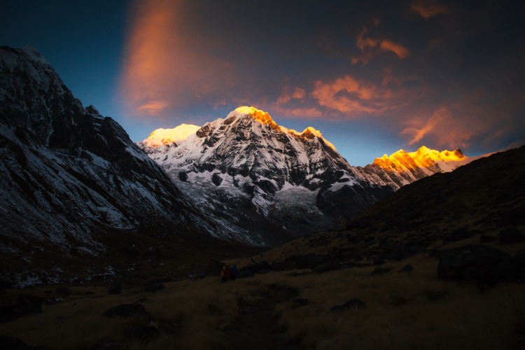
Today you will need to have plenty of water and your down jacket with you. Starting early in the morning you first ascend steeply for 1½ hours to a rock ledge and notch at 4,679m /15,350ft, then continue up along an ascending and undulating trail. This ascent will seem endless and be warned - there are several false summits - but there are great views back down the valley as you go. Finally, after anything from 3 to 5 hours, you arrive at the top of the Thorong La (5,414m /17,764ft) with its large cairn and many prayer flags. You will have spectacular views of the Annapurna Range to the south and the Mukat Himal bordering Dolpo to the west. The peak immediately south of the pass is Thorong Peak - this is a 'trekkers' peak' and you may see people climbing here.
You will probably not want to linger too long at the pass as it can be very cold and you will probably be feeling the effects of altitude. The descent to Muktinath is very steep and takes some 3 to 4 hours. This is where you might appreciate having walking poles to take the strain off the knees. During the descent there are splendid views of Dhaulagiri (8,167m/26,794ft) and Tukuche Peak (6,920m/22,703ft) and all the way down into the valley of the Kali Gandaki below. Finally you see the buildings of Muktinath coming in to view. You descend to the main village below the temples, which is actually called Ranipawa and not Muktinath, a name which technically refers just to the temple.
Dinner and overnight at the local lodge (Teahouse)
Meals Included: B/L/D
Accommodation: Local Tea House
Altitude: 5414 Meter to 3810 Meter
This morning you will have an opportunity to view the temples at Muktinath, after which you will begin your last day on trek. Here you leave the main trail and gradually climb to the grassy land on the southern side of Muktinath for 3 hours to reach the Lupra pass. The pass offers magnificent views of the mountains including Dhaulagiri, Tukuche, Dhampus peak, Nilgiri, Annapurna I, Tilicho and many others. From the pass you descend for nearly 2 hours to reach Lupra, the only village on the route following the Bonpo religion. You will have the opportunity to visit the monastery nearby. After lunch you walk along the river bank of Lupra Khola for another 45 minutes to meet the main trail of the Kali Gandaki. You then follow the normal route for an hour to reach Jomsom - a large settlement with a STOL (Short Take-Off and Landing) airstrip, police station and bank. The Kali Gandaki here is called the Thak Khola, from the ethnic group, the Thakalis, many of whom live in this area. Enterprising and ambitious, the Thakalis formerly dominated the salt trade with Tibet in this region and after its collapse diversified into running hotels along the trek route, construction and other businesses
Dinner and overnight at the local lodge (Teahouse)
Meals Included: B/L/D
Accommodation: Local Tea House
Altitude: 2713Meter
We take an early morning flight from Jomsom to Pokhara. It is a spectacular flight along the Kali Gandaki Gorge and provides wonderful views of both the Dhaulagiri and Annapurna ranges.
Free time or walking around lakeside market - Lakeside-The eastern shore of Phewa Lake, popularly known as lakeside or Baidam, is the favorite home base for travelers and is where most of the hotels, restaurants and handicraft shops are located.
Overnight at the hotel
Meals Included: B
Accommodation: Standard Hotel
Altitude: 822 Meter
If the flight from Jomsom to Pokhara is cancelled due to weather conditions or any other reason, you can continue your journey by taking a long but scenic drive, which typically takes about 6-7 hours. The drive offers an alternative to the flight, giving you a chance to experience the rural landscape of Nepal more intimately, though it may take longer to reach Pokhara
After the breakfast in the hotel, we will be transferred to the airport and take a 20 minutes flight back to Kathmandu. On arrival in Kathmandu, we’ll transfer to the hotel.
Evening Farewell to Nepal Dinner with a local cultural show
Overnight at the hotel
Meals Included: B
Accommodation: Standard Hotel
Altitude: 1336 Meter
Flights from Pokhara to Kathmandu are indeed subject to weather conditions, especially on monsoon season (June to September) or when there are low visibility or foggy conditions in the mountainous regions. These factors may cause flight delay or flight cancellation. In that case , alternative options include taking a private vehicle which typically takes around 6-7 hours.
Your free day to explore Kathmandu , you will have plenty of fascinating sights, cultural landmarks and experiences to enjoy . Here are some of the top things to do place to visit:
1.Swayambhunath Temple
2.Bouddhanath Temple
3.Bhaktapur/Kathmandu or Patan Durbar Square
4.Pashupatinath Temple
5.Thamel
6.Mountain Flight
Meals Included: B
Accommodation: Standard Hotel
Altitude: 1336 Meter
You are saying good bye to the mountains as your journey in Nepal comes to an end today! We hope you enjoyed the tour with us and we expect that you plan your next adventure in the wonderful country of Nepal again.
Approximately 3 hours before your scheduled flight time, our representative will transfer you to the airport.
Meals Included: B
Accommodation: Standard Hotel
Altitude: 1336 Meter
Includes/Excludes
Cost Included
- Permits required for Annapurna Conservation Area entry include the ACAP and TIMS Card for trekker safety and tracking.
- Transportation provided for Kathmandu to Jagat via Besisahar, Jomsom to Pokhara to Kathmandu flights usually covered, local transport for village transfers may be included.
- Licensed Trekking Guide provides cultural insights and ensures safety; Porter carries gear up to 10 kg for a more comfortable trek.
- Accommodation includes standard hotels in cities and basic but comfortable tea houses along the trekking route, usually on full board with Nepali or Western meals.
- Meals provided vary from traditional Nepali food during treks to breakfast in Kathmandu and Pokhara; snacks are included but drinks may cost extra.
- Trekking agencies offer insurance for guides and porters, including emergency coverage.
- Guides carry a basic first aid kit, but bringing personal supplies for common trek issues is recommended.
- In emergencies, satellite phones or radios may be available in remote areas.
Cost Excluded
- Airfare to and from Nepal not included in trekking package.
- Trekkers must arrange their own travel insurance for trekking activities, even though the guide and porter are insured.
- Personal expenses like snacks, drinks, and toiletries are usually not covered.
- Nepal visa fee not included in package.
- Tips for guide and porter appreciated but not mandatory.
- Optional extra services like accommodation or activities are usually not included.
- Consider bringing your own high-quality trekking gear instead of renting on the cheap.
FAQs
The Annapurna Circuit Trek is one of Nepal’s most iconic treks, offering stunning views of the Annapurna range, diverse landscapes, and vibrant cultural experiences. The trek takes you around the Annapurna Massif and provides incredible vistas of some of the highest peaks in the world, including Annapurna I, Annapurna II, and Machhapuchhre (Fishtail).
The trek typically takes 12 to 15 days, depending on the pace, weather, and acclimatization stops.
The highest point of the trek is Thorong La Pass at an elevation of 5,416 meters (17,769 feet), which is considered a challenging pass for trekkers.
The best seasons for the trek are:
- Spring (March to May): Mild temperatures and beautiful flowers in bloom.
- Autumn (September to November): Clear skies, ideal trekking conditions, and stunning mountain views.
The trek is moderately challenging. Some parts of the trek involve steep ascents and descents, especially when crossing Thorong La Pass. Acclimatization is important to prevent altitude sickness, and the trek requires a good level of fitness.
Yes, you will need the following permits:
- Annapurna Conservation Area Permit (ACAP)
- Trekkers’ Information Management System (TIMS) card
These can be obtained in Kathmandu or Pokhara before starting the trek.
Accommodation along the Annapurna Circuit is typically in teahouses. These are local lodges where you can find basic rooms with shared bathrooms. The rooms are simple, and most teahouses offer heating, Wi-Fi, and warm meals.
Some essentials include:
- Trekking boots, socks, and gloves
- Warm clothes for higher altitudes
- A waterproof jacket
- Sleeping bag (if not provided by the trek company)
- Headlamp, water bottles, sunscreen, and a first aid kit
- A good camera for the stunning views!
While it’s possible to trek independently, it’s highly recommended to trek with a guide or as part of a group for safety, particularly for navigating the challenging passes and ensuring proper acclimatization.
Bottled water is available along the route, but it’s best to bring a water purifier or water purification tablets to ensure safe drinking water. The trek also offers opportunities to refill water bottles at teahouses.
Most teahouses offer a range of local and international foods, including dal bhat (lentil soup), momos (dumplings), pasta, and fried rice. Vegetarian options are widely available.
Yes, it is highly recommended to have travel insurance that covers medical emergencies, trip cancellations, and helicopter evacuation in case of altitude sickness or injury.
Lower altitudes (1,000m – 2,500m): Pleasant and mild temperatures, but can be hot during the day.
Higher altitudes (3,000m – 5,000m): Cold weather with the possibility of snow, especially at Thorong La Pass.
Road Map


